Local Weather for Dublin, OH: (32°F/0°C) 
Rating: Rated 4+
Platform: Requires iOS 6.1 or later. Compatible with iPhone, iPad, and iPod touch.
Date Published: Jun 16, 2015
App Version: 2.7
Language(s): Language: English
Author: Colby Gauld
Application Description:
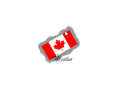
View weather radar animations and prognostic charts for Canada. Doppler radar images are provided by Environment Canada and prognostic charts are provided by NAV CANADA.
Canada Weather is location-aware and can automatically find the closest radar station. You can also select from a list of 31 stations nationwide, including five regional views: Pacific, Prairies, Ontario, Quebec, and Atlantic.
New in version 2.0 are the Surface Analysis and Graphical Area Forecast (GFA) charts. The Surface Analysis is a snapshot of the current pressure and frontal systems across Canada. GFAs give you a 12 hour forecast of the expected pressure and frontal systems at a regional level, along with information such as expected precipitation, cloud height & coverage, turbulence, icing, and freezing level.
Radar Features:
• Load up to 75 images
• Choose the sensitivity of radar images (rain or snow)
• Timecode overlay on each image
• Customize animation speed and delay
• Customize the overlays to view with each image
• Overlays: cities, more cities, roads, road numbers, rivers, and radar circles
Chart Features:
• Quickly switch between 0/+6/+12 GFA images
• Quickly switch between "Clouds and Weather" and "Icing, Turbulence, and Freezing Level" GFA images
See below for a complete list of radar stations and coverage:
• Regional Views - Pacific, Prairies, Ontario, Quebec, Atlantic
• British Columbia - Aldergrove (near Vancouver), Prince George, Silver Star Mountain (near Vernon), Victoria
• Alberta - Carvel (near Edmonton), Jimmy Lake (near Cold Lake), Schuler (near Medicine Hat), Spirit River (near Grand Prairie), Strathmore (near Calgary)
• Saskatchewan - Bethune (near Regina), Radisson (near Saskatoon)
Manitoba - Foxwarren (near Brandon), Woodlands (near Winnipeg)
• Ontario - Britt (near Sudbury), Dryden, Exeter (near London), Franktown (near Ottawa), King City (near Toronto), Montreal River (near Sault Ste. Marie), Northeast Ontario (near Timmins), Superior West (near Thunder Bay)
• Quebec - Lac Castor (near Saguenay), Landrienne (near Rouyn-Noranda), McGill (near Montréal), Val d'Irène (near Mont-Joli), Villeroy (near Trois-Rivières)
• New Brunswick - Chipman (near Fredericton)
• Nova Scotia - Halifax, Marion Bridge (near Sydney)
• Newfoundland & Labrador - Holyrood (near St. John's), Marble Mountain (near Corner Brook)
Get App

WeatherFarm is Canada’s largest farm weather network, with more than 1,000 stations across Western Canada. Beside offeMore...
The application Canada Weather for Android smartphones offers an experience of innovative weather.
Canada Weather hasMore...
A quick and easy way to get the weather forecast for your region updated in real time by meteorologists!
A weatheMore...

HK 9-day weather forecast with weather warning from HK Observatory, typhoon map, Air Quality Health Index (Air PollutionMore...
Stay up to date with the current weather conditions in the Netherlands - and in the world via the Weather station widgetMore...

L’application Météo-France, compatible avec votre Apple Watch : l’application météo de référence.
EMore...
Weather news and user generated content. You can submit photos and video and share content via email and Twitter and FacMore...
Canada's weather: essential Canadian weather information taken from the best source—Environment Canada—and presenteMore...