Local Weather for Dublin, OH: (32°F/0°C)

Weather Underground: Forecasts - The new Weather Underground Android app provides the world\'s most accurate hyper-local weather forecasts in addition to interactive radar, satellite maps and severe weather alerts. Powered by our unique community of weather enthusiasts reporting live data from weather stations in their own backyards, this crowd-sourced data generates forecasts targeted to your precise location. What’s New in Version 5.3● Global rain/snow start/stop time● Storm & tropical tracks are back on the map● Webcams are back in a new tile● Bug fixesFEATURES● Status notification: instantly view current temperature and conditions ● Current conditions from your local weather station include temperature, feels like, wind speed & direction, humidity, dew point, visibility● 10-day Forecasts (Daily, Hourly) + text summary● Interactive Map showing all the personal weather stations in your neighborhood with animated radar, satellite, and much more data● Favorite Locations and Recent Searches● Crowd reporting ● Light or Dark mode● Switch between Forecast on Demand & NWS Forecast● National Weather Service Radio● Health Tile: Monitor air quality, UV risk, & local flu outbreaks● Customizable Widgets● Push notifications:  keep an eye out for extreme weather with severe weather alerts● Purchase ad free subscriptions for $1.99 per yearWHAT MAKES THIS WEATHER APP DIFFERENT FROM OTHER APPS?WE FILL IN THE GAPSOur 200,000+ personal weather stations report the most localized weather conditions. The data that we collect from our user-owned weather stations fills in the gaps between the airport weather stations that other weather services rely upon to generate forecasts - meaning our data is generated from actual data points in your neighborhood.INTERACTIVE WEATHER & RADAR MAPThe most interactive weather map on mobile allows you to select from different weather overlays including current conditions, animated radar, satellite, webcams and severe weather. Customize the map by selecting specific data layers or choose from the various map presets such as severe alerts.CROWD REPORTINGSky reports let you tell us if the sky conditions we’re reporting are what you\'re actually observing. If you see something different you can report the conditions you\'re experiencing for the benefit of other app users. Hazard reports allow you to report any hazardous road conditions you experience to help other people in your area.ABOUT WEATHER UNDERGROUNDFounded in 1995 as the first online weather service, Weather Underground supplies weather data solutions to the many of the leading media companies and millions of users across the globe through their mobile apps and website wunderground.com. Weather Underground is part of the Weather Company and based in San Francisco, CA.

Weather Underground: Forecasts Android App

Rating: 4.5
Platform: 4.0 and up
Date Published: January 20, 2017
App Version: 5.6
Author: Weather Underground

Application Description:
The new Weather Underground Android app provides the world's most accurate hyper-local weather forecasts in addition to interactive radar, satellite maps and severe weather alerts. Powered by our unique community of weather enthusiasts reporting live data from weather stations in their own backyards, this crowd-sourced data generates forecasts targeted to your precise location.

What’s New in Version 5.3
● Global rain/snow start/stop time
● Storm & tropical tracks are back on the map
● Webcams are back in a new tile
● Bug fixes

FEATURES
● Status notification: instantly view current temperature and conditions
● Current conditions from your local weather station include temperature, feels like, wind speed & direction, humidity, dew point, visibility
● 10-day Forecasts (Daily, Hourly) + text summary
● Interactive Map showing all the personal weather stations in your neighborhood with animated radar, satellite, and much more data
● Favorite Locations and Recent Searches
● Crowd reporting
● Light or Dark mode
● Switch between Forecast on Demand & NWS Forecast
● National Weather Service Radio
● Health Tile: Monitor air quality, UV risk, & local flu outbreaks
● Customizable Widgets
● Push notifications: keep an eye out for extreme weather with severe weather alerts
● Purchase ad free subscriptions for $1.99 per year

WHAT MAKES THIS WEATHER APP DIFFERENT FROM OTHER APPS?

WE FILL IN THE GAPS
Our 200,000+ personal weather stations report the most localized weather conditions. The data that we collect from our user-owned weather stations fills in the gaps between the airport weather stations that other weather services rely upon to generate forecasts - meaning our data is generated from actual data points in your neighborhood.

INTERACTIVE WEATHER & RADAR MAP
The most interactive weather map on mobile allows you to select from different weather overlays including current conditions, animated radar, satellite, webcams and severe weather. Customize the map by selecting specific data layers or choose from the various map presets such as severe alerts.

CROWD REPORTING
Sky reports let you tell us if the sky conditions we’re reporting are what you're actually observing. If you see something different you can report the conditions you're experiencing for the benefit of other app users. Hazard reports allow you to report any hazardous road conditions you experience to help other people in your area.

ABOUT WEATHER UNDERGROUND
Founded in 1995 as the first online weather service, Weather Underground supplies weather data solutions to the many of the leading media companies and millions of users across the globe through their mobile apps and website wunderground.com. Weather Underground is part of the Weather Company and based in San Francisco, CA.

Get App

Check out these related apps
PokeRadar-Poke Radar Go Map Vision For Pokémon GO - Poke Radar for Pokemon GO is an assistant app for discovering the location of any Pokemon that\'s been found by other players.Using Poke Radar for Pokemon GO is extremely simple. You can view all of the nearby Pokemon in your area that have been discovered by your self and other players on the map, along with the times of day they were found. If you\'re trying to find a specific Pokemon\'s location, you can quickly use the \

PokeRadar-Poke Radar Go Map Vision For Pokémon GO iOS App

Poke Radar for Pokemon GO is an assistant app for discovering the location of any Pokemon that's been found by other plaMore...
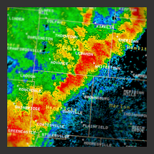
Weather Radar Widget - Three fixes in version 1.7.6:   1) The \

Weather Radar Widget Android App

Three fixes in version 1.7.6:

1) The "rock back and forth" mode checkbox was previously not saving its state pMore...
RadarScope - RadarScope is a specialized display utility for weather enthusiasts and meteorologists that allows you view NEXRAD Level 3 and Super-Resolution radar data along with Tornado, Severe Thunderstorm, Flash Flood Warnings, and predicted storm tracks issued by the U.S. National Weather Service. It can display the latest reflectivity, velocity, dual-polarization, and other products from any NEXRAD or TDWR radar site in the United States, Guam and Puerto Rico, as well as reflectivity and velocity data from Environment Canada radars, and two radars in South Korea. These aren\'t smoothed PNG or GIF images, this is native radar data rendered in its original radial format for a high level of detail. Whether you are scanning reflectivity for a mesocyclone\'s tell-tale hook echo, trying to pinpoint the landfall of a hurricane\'s eye wall, or looking for small features like velocity couplets in the storm relative radial velocity product, RadarScope gives you the power to view true radial NEXRAD weather radar on your Android device.RadarScope displays tornado, severe thunderstorm, and flash flood warnings issued by the U.S. National Weather Service. When warnings are in effect, you can tap the warning button in the upper right corner to browse the list of active warnings, select a warning to view the details, and even zoom to the selected warning on the map. (Not available in Canada).Pinch or stretch to zoom in and out. Drag your finger around the map to scroll. Tap the radar sweep button in the toolbar to switch radars. Select one of the 156 different NEXRAD radar sites and 45 Terminal Doppler radars in the US, 30 other radar sites in Canada, and 2 in the Republic of Korea. Plot your current location by tapping the location button and optionally report it to the Spotter Network. Tap the play button to download and animate over recent images. Display the names of over 25,000 cities and towns on the map as you zoom and scroll. Tap and hold the color legend to see the data values. Meanwhile, RadarScope will retrieve and display updated data automatically and intelligently (approximately every 2 to 10 minutes, depending on the radar scan strategy). You can display data from NOAA\'s public access web site, our optional WDT feed (the default), or your AllisonHouse subscriber account. Spotter Network members can report their location and view the locations of other spotters.The RadarScope Pro subscription is an optional add-on data set. It provides access to real-time lightning data that animates along with the radar loop and up to 20 frames of radar data, including *extended loops* of Super-Res Level 2 data. Super-Res Level 2 data is still available to all RadarScope users without purchasing a subscription.RadarScope Pro subscribers can also access a data interrogation tool to quickly determine data values for specific radar pixels and an optional dual-pane mode for viewing two radar products side-by-side.Please visit our web site for more information.

RadarScope Android App

RadarScope is a specialized display utility for weather enthusiasts and meteorologists that allows you view NEXRAD LevelMore...

Hurricane Track - Radar and Tropical Storm Tracker - Hurricane Track 3.0 is the most advanced, modern, and easiest to use Hurricane Tracking and Radar application!  Hurricane Track 3.0 features incredible new features such as 12 World Radars, a new customizable dynamic Local Radar using NEXRAD \

Hurricane Track - Radar and Tropical Storm Tracker iOS App

Hurricane Track 3.0 is the most advanced, modern, and easiest to use Hurricane Tracking and Radar application! HurricanMore...

WeatherBug - Local Weather, Radar, Maps, Alerts - Get Canadian weather conditions & forecasts for all provinces and cities in real-time, and Doppler radar so you can Know Before™ severe weather arrives from WeatherBug - the free weather app powered by the world’s largest professional weather network!“I love WeatherBug! It’s always accurate and is the first place I go for up-to-the minute weather!” –iOS UserBe prepared. Download the app used and loved by millions, voted the “Best Weather App for iPads” by AppPicker, and “Best App for Moms” by Parent Magazine -- WeatherBug!FEATURES• Doppler radar coverage available across Canada and North America• New Apple Watch complications allows you to quickly view current weather• Enhanced iOS widget to check local weather at a glance• 3D touch support so you can quickly access your weather (only supported by iPhone 6S and higher)TRACK ANY CONDITION• Fastest Weather Alerts: Get notified of severe weather 50% faster with our exclusive Dangerous Thunderstorm Alerts• Largest Weather Network: Gain access to our patented Total Lightning Network® technology and over 10,000 professional weather stations• Spark™ Lightning Alerts: Know the risk of lightning strikes and get real-time lightning proximity alerts and a map of nearby lightning strikes• Real-Time Forecasts: Get the most accurate current, hourly and 10-day weather forecasts• Enhanced Interactive Maps: Visualize weather conditions with 18 weather map layers• Traffic & Satellite Maps: View current traffic conditions and satellite views on each of our 18 weather map layers• Apple Watch Support: Get vital weather alerts and conditions directly on your Apple Watch through glances and complications• Lifestyle Forecasts: Stay informed on weather and its impact to your winter activities and health with our ‘Ski & Snow’ and ‘Cold & Flu’ forecasts• Hurricane Center: See up to date hurricane forecasts and changing weather conditions to protect you and your loved ones• Weather News: Stay up to date with all the severe storms from our meteorologists along with news from the Associated PressCUSTOMIZE YOUR WEATHER• Multi-language Support: English, Spanish, and Portuguese• Temperature Units: Celsius or Fahrenheit• Wind Units: KPH, MPH, Knots or MPS• Pressure Units: Inches or millibarsAD-FREE VERSIONLike WeatherBug, but don’t like ads? Get our $3.99 in-app purchase for a 1 year subscription for an ad-free experience!FEEDBACKWe love feedback, so tell us what you think! Send us your thoughts, questions or suggestions to iphoneapps@weatherbug.com.

WeatherBug - Local Weather, Radar, Maps, Alerts iOS App

Get Canadian weather conditions & forecasts for all provinces and cities in real-time, and Doppler radar so you can More...
Radar Alive Pro Weather Radar - Now with selective spotter tracking! Radar Alive! brings weather radar to your phone or tablet from all US states and Puerto Rico. Watch tornadoes, hurricanes and other weather events live and in Level III detail. Monitor your local weather radar. See warnings on the map, and warning text. Track storm chasers and report your own position through Spotter Network. Easily switch to the nearest doppler radar with a long press on the map. See weather observations on the METAR layer.Radar Alive! is suitable for storm chasers, professional meteorologists, emergency personnel, SKYWARN spotters and weather enthusiasts. It has a wide selection of US radar products (image types). NWS severe weather warnings are displayed along with a customizable low clutter map with cities, roads, counties and states. The display is suitable for both phones and tablets.Choose from a complete menu of radar products at multiple tilt angles, including composite and base reflectivity, base and storm relative velocity, VIL, hydrometeor classification (type of precipitation) and others.  Spot tornadoes with the velocity and base reflectivity plots; view warning boxes and warning text; watch hail with the hydrometeor classification display. Radar Alive!\'s precision images are generated from NOAA\'s NEXRAD Level III binary data (NWS weather radar).  Carefully simplified maps minimize clutter on the radar display.With an AllisonHouse subscription, you get an alternate source of radar data, along with new products including lightning, watches, local storm reports, and SPC Day 1 convective outlookThe serious user will appreciate advanced features, such as smart GPS usage to conserve battery power; network bandwidth conservation; and, maps optimized for weather radars.A full Spotter Network client is included. It can display the positions of all or selected active Spotter Network users. You can use it to automatically report your position to Spotter Network, and to make reports of weather events. When the main app is not in use, it can run in the background, where it can be controlled from an icon in the notification bar of the device.Radar Alive! was written by a veteran storm chaser for the serious meteorological user.Extensive help is available within the app. If you experience problems, or to learn how to best use Radar Alive Pro, use the menu button to select the help pages or ask for advice or support on the supplied form.Support is also available by email, and suggestions are welcome.More information is available at the developer\'s web site at developer\'s web site.

Radar Alive Pro Weather Radar Android App

Now with selective spotter tracking!

Radar Alive! brings weather radar to your phone or tablet from all US stateMore...
MyRadar Weather Radar Ad Free - MyRadar Ad Free is the ad-free version of the leading free radar app, MyRadar. It is a fast, easy-to-use, no-frills application that displays animated weather radar around your current location, allowing you to see quickly what weather is coming your way. Just start the app, and your location pops up with animated weather!The map has the standard pinch/zoom capability which allows you to smoothly zoom and pan around the United States and see what the weather is like anywhere. MyRadar shows animated weather, so you can tell if rain is headed toward or away from you, and how fast. In addition to the free features of the app, a few additional in app purchases are available;  see severe storm warnings for your area, as provided by the National Weather Service, and real-time hurricane tracking - great for the start of hurricane season!Download MyRadar today and try it out!

MyRadar Weather Radar Ad Free Android App

MyRadar Ad Free is the ad-free version of the leading free radar app, MyRadar.

It is a fast, easy-to-use, no-friMore...
Rain Alarm - Radar & Push - Don\'t get caught in the rain!Fed up with incorrect weather forecasts? Rain Alarm reliably warns you of rain or snow approaching your location using push notifications. Instead of predicting probabilities, we use real time data to warn you as soon as precipitation gets near.The app animates the latest Doppler-radar images from weather services around the world. Rain Alarm is useful for everyone that likes to spend time outside and doesn’t want to get caught in the rain!In the following countries we provide service:Germany, Austria, Netherlands, Spain (incl. Balearic and Canary Islands), Slovenia, Croatia, Belarus, Ukraine, United Kingdom, Ireland, Finland, Norway, Iceland, USA, Canada, Mexico, El Salvador, Argentina, Australia, Taiwan, Japan, Republic of Korea, Malaysia, Singapur, Brunei and the Philippines.You like Rain Alarm? Support us by leaving a good review at the app store! For suggestions and complaints, please contact us directly via Email or Facebook:rainalarm@avilessoftware.com  https://www.facebook.com/rainalarm/?fref=ts

Rain Alarm - Radar & Push iOS App

Don't get caught in the rain!

Fed up with incorrect weather forecasts?

Rain Alarm reliably warns you of rMore...