Local Weather for Dublin, OH: (32°F/0°C) 
Rating: 4.4
Platform: 4.1 and up
Date Published: December 27, 2016
App Version: 1.3
Author: Apalon Apps
Application Description:
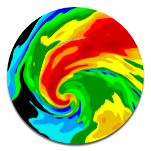
Get a powerful yet easy-to-use weather station right on your device with Weather Radar & Alerts. Real-time animated weather radar images on a highly interactive map enhanced with severe weather warnings provide accurate weather forecast and don’t let bad weather take you by surprise.
The app reflects the real-time weather conditions and provides you with detailed meteo data you need to know: current and "Feels Like" temperature, the chance of precipitation and humidity info, pressure changes, wind speed and wind direction, visibility details and more. Precise and reliable weather radar tracks the latest weather activity to secure you on road trips.
Take a quick look at current weather conditions or go advanced and take the most of the top notch functionality of the app. Get a push notification whenever an alert is issued (tornadoes, flood warnings, snow storms, and more) without opening the app!
Real-time animated meteo radar on a highly interactive terrain or satellite map enhanced with severe weather warnings and alerts will meet the needs even of the most demanding users. Rainy, snowy, stormy or cloudy weather, you’ll be prepared to any!
Short-term (24-hour) and long-term (7-day) weather forecast for any location.
Customize your weather report according to your taste. Choose the information you would like to receive: “Feels like†temperature, pressure, humidity, precipitation information. Add or delete sunrise and sunset time.
Units of measurement:
- Pressure in inches, mm, kPa or mbar,
- Fahrenheit/Celsius and Miles/Kilometers,
- Wind speed in mph, km/h, m/s, knots, Beaufort.
Easy location search:
Toggle between cities and spy on weather in other parts of the world. Bookmarked locations will help quickly switch to your favorite spots and check today’s weather or find out the forecast for tomorrow.
Radar, Satellite and Rain overlays:
Get real-time snow and rain tracking or mixed precipitation data, and cloud cover in high resolution and vivid colors.
Customizable overlays:
Choose background maps, the number of frames; adjust opacity and loop speed for the overlays.
Resizable widget:
Add a nice customizable widget to your screen and get the live-updated weather information you want to know without opening the app.
More handy options for the best user experience!
You can give locations a personalized name, such as “Home†or “Workâ€. And select individual frames in the animation cycle by moving the slider indicator when the animation is paused.
National Weather Service watches and warnings are shown on the map as interactive warning boxes highlighting the territories they're active for. Tap any to get the card with the full alert text.
Coverage Info:
Radar images are available for the United States (Continental US, Alaska, Hawaii, and Puerto Rico), Canada, Australia, European Union (the United Kingdom, Ireland, Germany, France, the Netherlands, Belgium, Luxembourg, Liechtenstein, Switzerland, Italy (western), Denmark (southeast), Poland (western), Czech Republic, Austria (northwestern), Japan.
Rain map, satellite images, and detailed weather info is available worldwide.
IMPORTANT DISCLOSURES AND CONSENT
By clicking to install this app you consent to the installation of this app and any updates or upgrades that are released. You understand and agree that this app (incl. any updates or upgrades) may (i) cause your device to automatically communicate with our servers to deliver the functionality described above and to make our products more efficient and effective, (ii) affect app-related preferences or data stored your device, and (iii) collect personal information to provide the features described above and as set out in our privacy policy. You can uninstall the app at any time. For assistance, please contact us at
IAC Search and Media Europe Ltd.
Unit 1, Digiweb Building
College Business and Technology Park
Blanchardstown North Road, Dublin 15 Ireland
ApalonPrivacy@ask.com
Get App
Thanks to everyone for making MyRadar so successful, with over 25 million downloads!
MyRadar is a fast, easy-to-uMore...
NOAA World Radar is the most complete, reliable, and stunning weather radar app available.
Use World Radar to seeMore...

Get your family and home ready for a tornado. The American Red Cross tornado app is the complete solution you need to unMore...

Hurricane tracking on a Google Maps background. Shows the tracks and forecasts of active hurricanes tropical storms. AlMore...

Help keep your family safe in severe weather, man made/natural hazards with Emergency by the American Red Cross. MonitorMore...
Simple yet powerful app that shows hi-definition real-time animated weather radar images with snowfall, hurricane tracksMore...

House fires, floods, power outages, and even catastrophic earthquakes – whatever the disaster, the official Canadian RMore...
Simple yet powerful app that tells you how much it's going to snow in the next couple of days in precisely *your* neighbMore...